Top 25 Geological Discoveries in the Last 50 Years
Within the past fifty years, geologists finished the chore of filling in “blank spaces” in maps by foot, especially in the Antarctic. By the time that chore was accomplished in the 1960s, the theory of plate tectonics was developed, and new tools such as satellites and digital mapping allowed geologists to map other spaces that cannot be reached by foot — including ocean floors and planets. The study of astrogeology was born, and new focuses centered on ridges along plate borders, and geologists now are making new discoveries almost daily with these theories and tools at their fingertips. The following list of the top 25 geological discoveries in the past 50 years includes some of the most important discoveries covering facets such as paleontology, technology, astrology, and even biology and how these studies can interact with geology.
 Early 1950s: Lamont Geological Observatory of Columbia University geologists surveyed ocean basins with newly-refined depth recorders. They discovered the globe-encircling mid-ocean ridge system, and suggested that oceanic crust is created at these chains of submarine volcanoes. The theory of plate tectonics was born from this research.
- 1953: Clair Cameron Patterson, a U.S. geochemist, made the first precise measurement of the Earth’s age — 4.55 billion years.
- 1957: The Soviet Union launched Sputnik 1, the world’s first artificial satellite, and the U.S. satellite, Explorer 1, was launched four months later. Remote sensing consists of using aerial photography and other methods to view what cannot be seen with the unaided eye, and this new technology spawned many other geological tools.
- 1958: The Gamburtsev Mountain Range (also known as the Gamburtsev Subglacial Mountains) is a subglacial mountain range located in Eastern Antarctica. The range was discovered by the 3rd Soviet Antarctic Expedition in 1958 and is named for Soviet geophysicist Grigoriy A. Gamburtsev.
- 1958: Gaston de Gerlache discovered a chain of mountains about ten miles long in Queen Maud Land in the Antarctic. Gerlache named the chain the Belgica Mountains, after the ship, Belgica, which was commanded by his father, Lt. Adrien de Gerlache, leader of the Belgian Antarctic Expedition of 1897-99.
- 1960s: The development of the GBF-DIME files by the U.S. Census Bureau in the 1960s marked the large-scale adoption of digital mapping by the government. Important geographic work was also being done at universities throughout the 1960s. A grid-based mapping program called SYMAP, developed at the Laboratory for Computer Graphics and Spatial Analysis at the Harvard Graduate School of Design in 1966, was widely distributed and served as a model for later systems.
- 1961: Geologists Harry Hess and Robert Dietz propose that seafloor spreading and subduction are basic parts of the mechanism for plate tectonics - a finding that led to the rapid acceptance of the tectonic theory behind Earth’s large-scale geologic changes.
- 1961: Eugene Merle Shoemaker, a geologist, pioneers the field of astrogeology by founding the Astrogeology Research Program of the U.S. Geological Survey in 1961 at Flagstaff, Arizona.
- 1964: members of the ninth Soviet Antarctic Expedition discover the Vernadskii Subglacial Mountains in East Antarctica. They are named in honor of V. I. Vernadskii.
 1965: Canadian scientist John Tuzo Wilson supported Harry Hess’ work on plate tectonics, and expanded the theory with the suggestion that earth’s features are not isolated, but that they are connected into a continuous network of mobile belts around the Earth which divide the surface into several large rigid plates.
- 1972: The Landsat satellite program launches. Images are used to measure rain forest loss, assist with mapping, determine urban growth, and population change, and images and data are available to countries around the world. This project is a joint venture between NASA and the U.S. Geological Survey.
- 1972: The Louisville seamount chain was first detected using depth soundings collected along random ship crossings of the South Pacific. Six years later the full extent of this chain was revealed by a radar altimeter aboard the Seasat (NASA) spacecraft. Recently, high density data collected by the Geosat (US Navy) and ERS-1 (European Space Agency) spacecraft data show the Pacific-Antarctic Rise and the Louisville Ridge in unprecedented detail.
- 1984: The United States Department of Defense used the Geodetic Reference System, 1980 (GRS 80) and Doppler satellite images to create a new, more accurate world geodetic system. This became what is known today as WGS (World Geodetic System) 84.
- 1983: David M. Raup and J. John Sepkoski, Jr. identified the “Big Five” mass extinctions — End Ordovician, Late Devonian, End Permian, End Triassic, and End Cretaceous.
- 1993: On June 26th this year, the U.S. Air Force launched the 24th Navstar satellite into orbit, completing a network of 24 satellites known as the Global Positioning System, or GPS.
- Mid 1990s: LiDAR (also known as LaDAR ot Laser Detection and Ranging) has been used extensively for a wide range of purposes. It was only with the deployment of Global Positioning Systems (GPS) in the 1980s, allowing the precise positioning of aircraft, that LiDAR made airborne surveying possible. By the mid-1990s, laser scanner manufacturers were delivering LiDAR sensors to commercial customers intending to use them exclusively for topographic mapping applications.
- 1991: Many miners make geological discoveries, and the EKATI Diamond Mine was discovered by two geologists. This is Canada’s first surface and underground diamond mine, which Chuck Fipke and Stewart Blusson had been prospecting since 1985.
- 1999: Brian Coffey discovers a new late-Triassic Period species in North Carolina at a site that was once just below the surface of an ancient lake or river bed. The 221-million-year-old reptile was an evolutionary halfway mark between dinosaurs and crocodiles.
- 2000: A research crew aboard the Atlantis discovers Lost City, a forest of majestic tall white limestone chimneys adjacent to the Atlantis Massif in the Mid-Atlantic Ridge.
- 2002: The Grand Staircase-Escalante National Monument (GSENM) in Kane County, Utah, has been a playground for geologist David Gillette’s team from the Museum of Northern Arizona (MNA). This year they found an almost complete skeleton of the Therizinosaurid dinosaur.
- 2005: Google purchases EarthViewer 3D, renames it Google Earth, and makes it available to anyone who can download the application. Originally created by a Central Intelligence Agency (CIA) funded company, this app maps the Earth by the superimposition of images obtained from satellite imagery, aerial photography and GIS 3D globe.
- 2008: Three Australian scientists announced the discovery of an ancient reef in the Flinders Ranges in the South Australian outback, in an area that was once covered in water. In the only reef complex discovery of its age anywhere in the world, the 650 million-year-old reef predates the age of the dinosaurs and scientists say fossilized remains in the reef could contain clues to the earliest forms of multi-cellular life yet discovered.
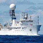
 2010: Scientists aboard the Okeanos Explorer discovered an enormous volcano, the Kawio Barat volcano, looming 7,000 feet below the ocean’s surface off the coast of Indonesia.
- 2012: A giant mass of sand large enough to bury all of Manhattan under dunes more than 50 stories tall apparently erupted from the floor of the North Sea hundreds of thousands of years ago, the largest such body of sand ever found in the world, researchers say.
- 2012: The National Science Foundation and the Japanese government sponsored a geological trip to the Atlantis Massif. For the first time, a team of researchers lowered instruments to depths between 2,600 and 4,600 feet (800 and 1,400 meters) below the seafloor to take data on temperature and the way that seismic waves move through two different types of gabbroic rock.